Pixels and Plans is a creative technology studio founded by long-time collaborators Julia Krolik and Owen Fernley. They design, code and strategize to develop innovative products incorporating both art and science into their methods. Pixels and Plans bridge the gap between inaccessible knowledge and the public by harnessing the powers of technology and imagination.
CSUCH - Data Visualizer, March 22, 2019
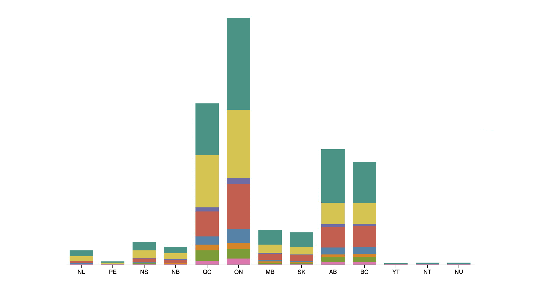
This data visualization tool displays the costs and harms of substance use in Canada, and offers options to filter and compare the data to better explore and understand trends and changes in how Canada spends its resources on substance use and addiction. This data is provided by Canadian Substance…
Community Flow, March 13, 2018
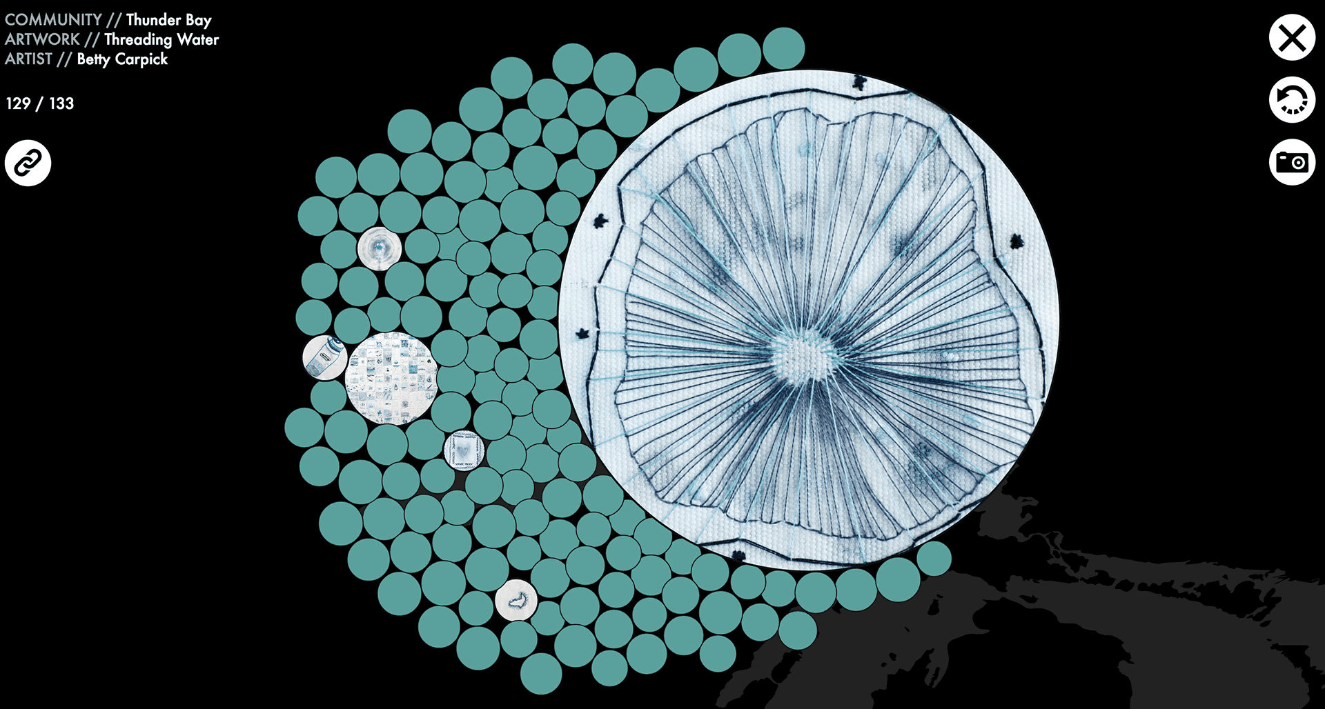
Community Flow was created to bring together artworks from eight communities on the Canadian side of the Great Lakes. Each community had an artist work alongside volunteers to create one artwork from many smaller contributions. This project was to feature each of the final artworks, as well as the…
Hyasynth Bio, January 18, 2018
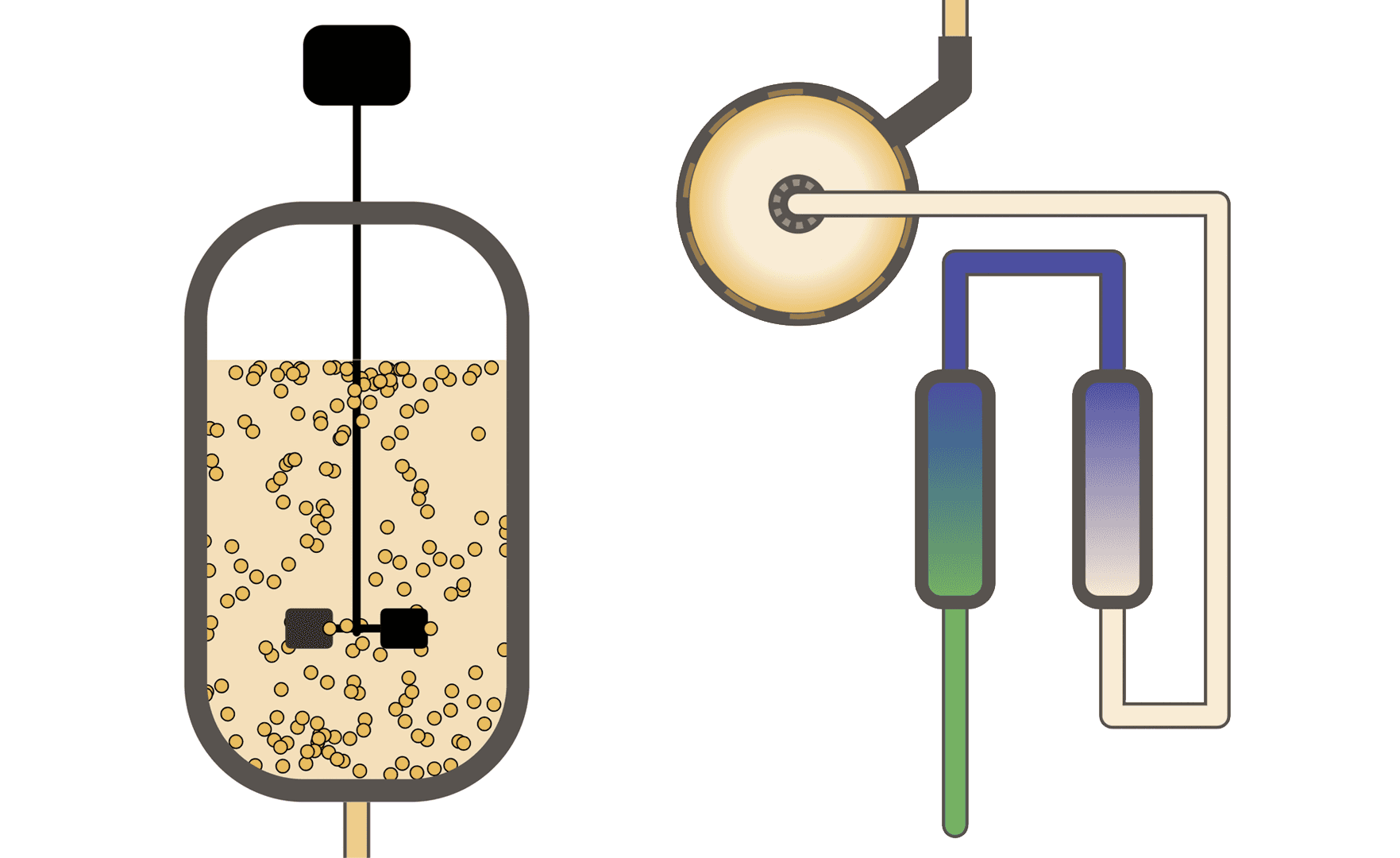
Hyasynth Bio (Montréal, QC) contacted us to see if we would be interested in describing their industrial process they use to produce synthetic cannabis. A scroll story was created that allowed visitors to their site to follow the process from raw ingredients to finished products. One of the main…
Tuberculosis Sample Study, November 23, 2016
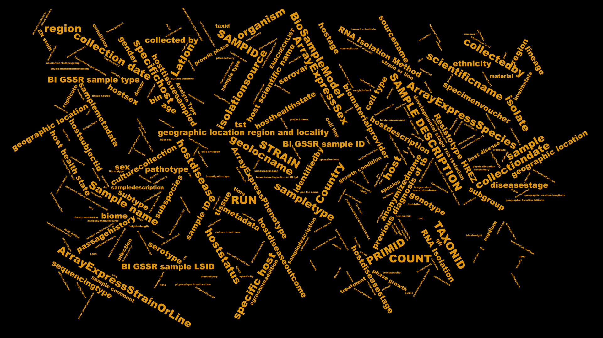
28,000 tuberculosis (TB) sample entries were extracted from the NCBI Database in order to better understand the wide array of descriptors entered at the time these samples were uploaded. A custom frequency-based word cloud was created from all 322 descriptors to highlight the difficulty in…
Depth to Water, October 16, 2016
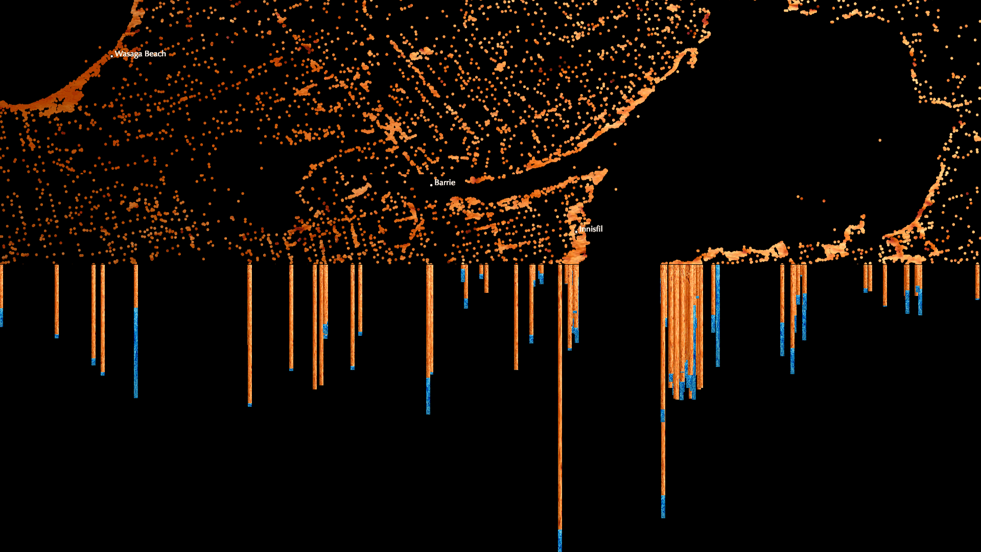
Depth to Water was created for the 17th Canadian National Conference on Drinking Water in Ottawa, Ontario to showcase how 367,089 private-well water data points can map the geography of Southern Ontario, Canada. Additionally, Depth to Water displays the depth at which water was found for each well…
Intersection, September 05, 2014
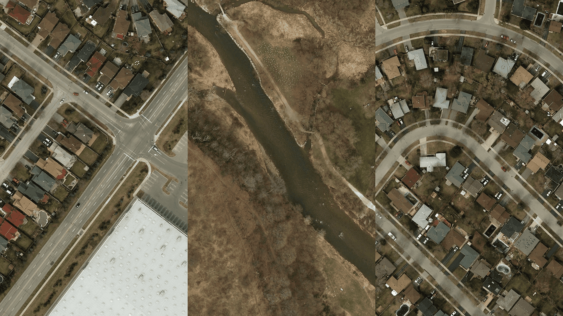
Originally created for an exhibition with the Agitated Plovers Salon, Intersection went on to win the Canadian Urbanism Award at the Toronto Urban Film Festival (TUFF) in September 2014, and was subsequently displayed across Toronto Subway stations in May 2015. Randomly displaying images from a set…